MARCH BASE UPDATE NOZAWA
It’s all about the base

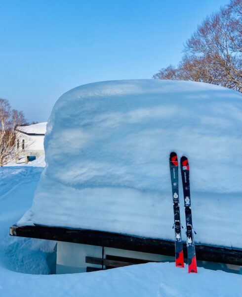
At this time of the year it is all about the base and we still have a solid one just sitting at 2.5 Meters up top at Yamabiko. This opening shot just 2 days ago. All these sunny spring days naturally chip away at it but the winds have been light so there isn’t that hair dryer affect that can melt it fast. Looks like tomorrow we will see a nice dip in temps and a bit of a snow top up too and we are hoping for another few light top ups throughout March. So the big question is when will the Ski Season run until?
Most years we make it through to Golden Week, the first week of May. Just snow coverage up the top at Yamabiko by then but a bit of a novelty ski at that time of year. Fingers crossed we make it to that date again this year. We are positive that there will be fun spring ski conditions to enjoy in Nozawa throughout March and April.

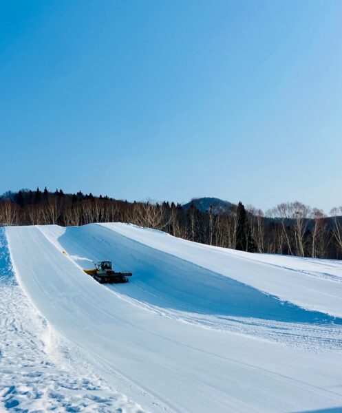
Sunday is looking like another great day on the mountain with the base at 245cm, we still have plenty more riding to do. The park will be awesome this morning before the sun gets into it. The groomers also being the pick with that fresh corduroy. Temperatures are set to a max of 7 degrees on top of the mountain with a max of 16 degrees in the village, a beautiful spring day. Winds are light and variable for majority of the day from the S, but in the evening the winds will intensify, blowing in a small cold front. Visibility on the mountain should be great but some cloud may hinder the view of the surrounding mountains.
If you’d like to join us for a last minute holiday and some awesome spring skiing, you can check out our accomodation options here; https://www.nozawaholidays.com/properties/

🌄TODAY:
Temperature at the top; Yamabiko 5, Uenotaira 6
New snow since yesterday; 0cm
Base at the top; 245cm
Snow conditions; Fresh corduroy on piste will be fast and fun
Weather; Sunny all day with slight cloud coverage
🚡LIFTS IN OPERATION: All except Karasawa
🌄RUNS OPEN: All except Kandahar and Yunomine Slope A
FORECAST:
The forecast is looking strong with the cold front blowing in late tonight still promising 15cm+ of snow to fall tomorrow. Monday will see the return of temperatures in the negatives and the wind chill pushing it further down. Winds will be light and variable for most of the day from the SE in the morning turning NW at midday. Tuesday, the clouds roll out throughout the morning giving us a beautiful bluebird day but the air temperature will stay in the negatives and should be an awesome day. Wednesday the temperatures will rise back into the positives with clear sunny skies.
Have a terrific Sunday, lots of visitors here for the weekend but many will head back to Tokyo this afternoon. Should be a very quiet week on the slopes ahead.


