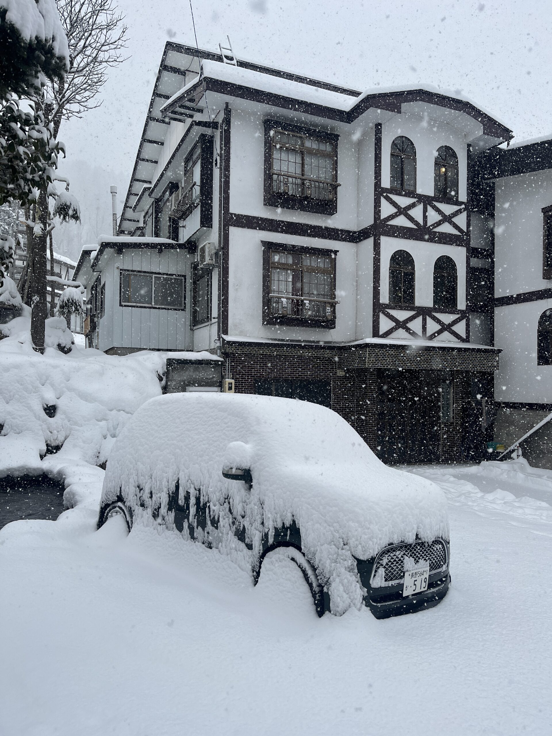

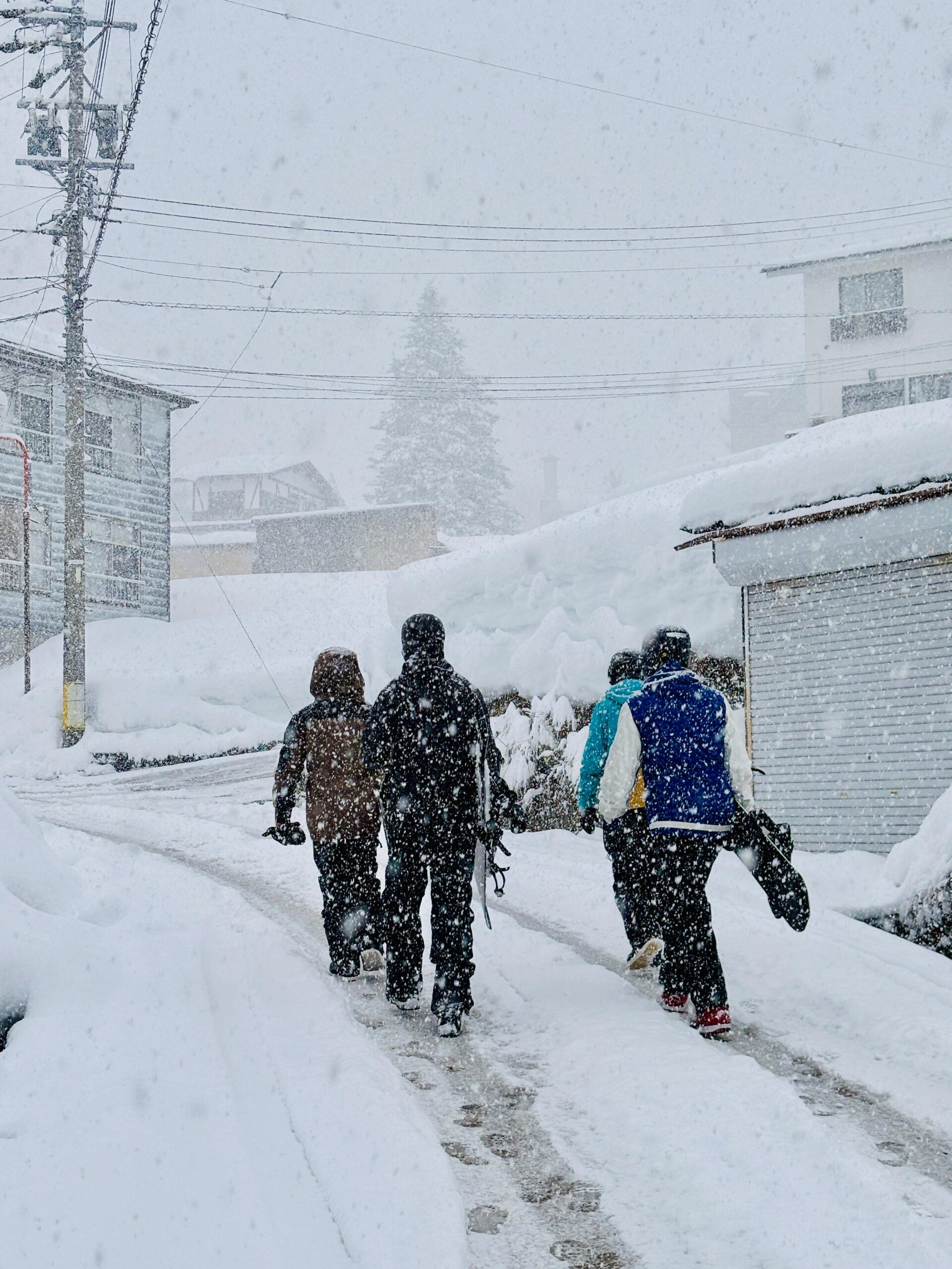
The snowstorm has arrived!
The snowstorm has arrived!
The snow just keeps coming! 🌨️ With the latest forecast update, snowfall predictions have jumped even higher—now expecting a total of around 2.5 meters by early next week! Strong western winds will keep the snow coming consistently, so be sure to allow extra time to get around and stay safe on the roads and slopes. Yesterday’s sunshine made for an incredible day on Mt. Kenashi, with perfectly groomed runs and crystal-clear visibility. But now, it’s all about the powder 🤍
How deep do you think the snow base up top will be by the end of the week? Drop your guesses below! Stay safe out there, embrace the storm, and enjoy the magical snowglobe that is Nozawa! ❄️✨
TODAY:
🌡️ Temperature at the top: -9 degrees
❄️ New snow since yesterday: 11cm
🏔️ Base at the top of Nagasaka: 280cm
❄️ Snow conditions: Freshly groomed slopes
🌤️ Weather: Heavy snow
⛷️ Runs: All runs open
🚡 Lifts: All lifts running

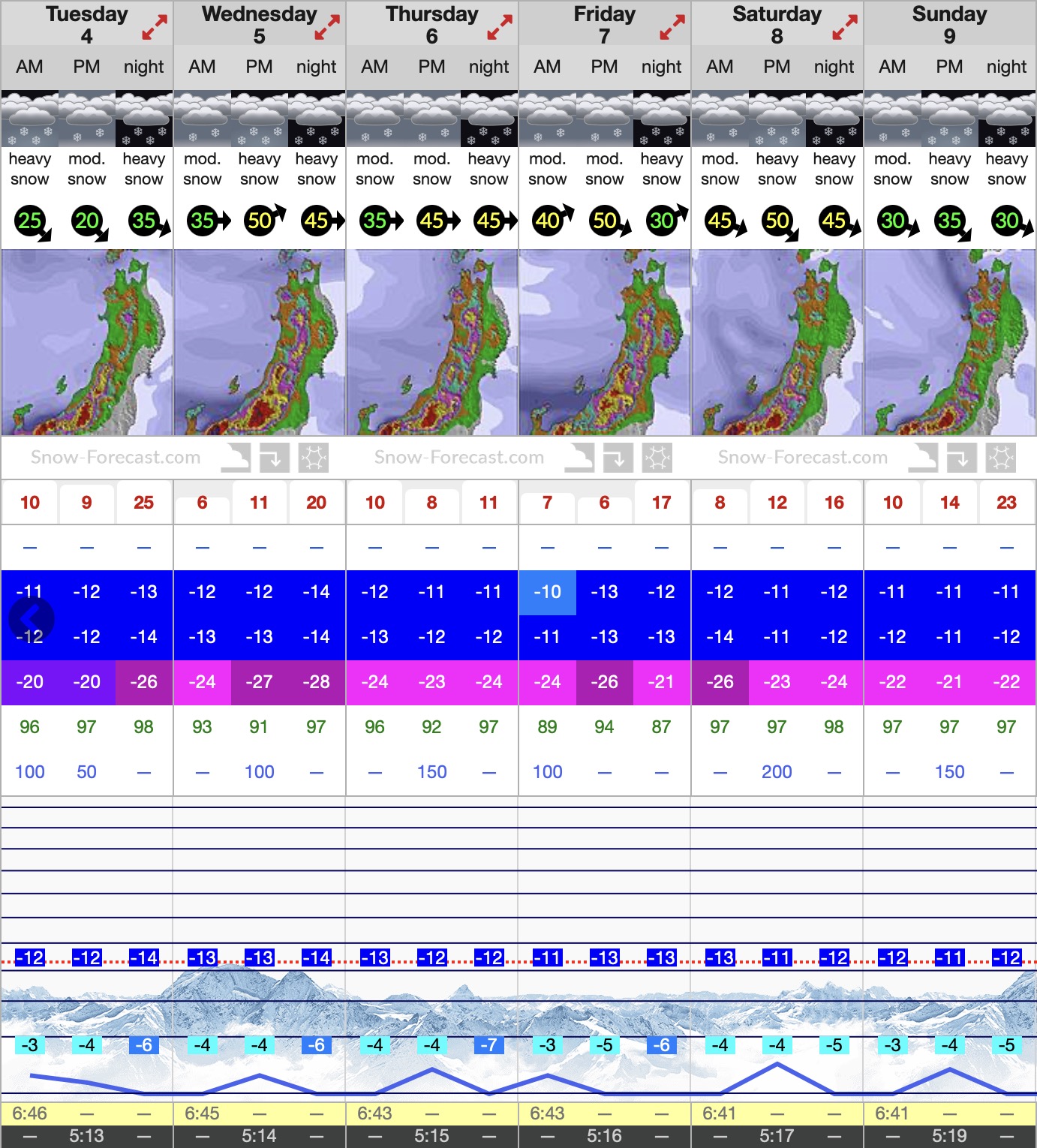
❄️ SNOW FORECAST:
Heavy snowfall is expected throughout the week, with totals stacking up to 2.5 meters by early next week. The heaviest dumps are forecast for Wednesday, Saturday, and Sunday, fueled by strong western winds reaching up to 50 km/h at times. Expect deep powder conditions, but also potential lift delays and reduced visibility in exposed areas.
Temperatures are staying brutally cold, with highs of around -10°C to -12°C and lows dropping into the -20s at higher elevations during the night. This means light, dry powder, perfect for riding, but be sure to layer up. Avalanche risks may rise in off-piste areas, so take care if venturing beyond the resort boundaries.
Stay safe and enjoy the legendary Nozawa conditions!